Before proceeding to the evidences we need to understand how the ancient maps were structured.
The history of ancient maps is too long, but I will try to make it shorter. (start with Early World Maps)
The first reported map is the Babylon map of the world dated 6th century BC.
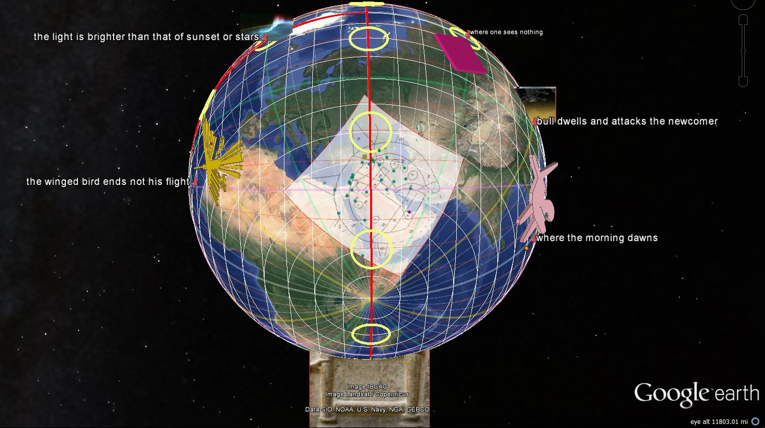
This map has is centered in Babylon and is surrounded by 7 Islands, where 5 are named:
- 3rd Island: where "the winged bird ends not his flight". Our interpretation: the direction of Atlantic Ocean.
- 4th Island: "the light is brighter than that of sunset or stars". Our interpretation: the direction of Greenland (Northern Lights).
- 5th island: "where one sees nothing," and "the sun is not visible". Our interpretation: the direction of North Pole or Siberia (The dark nights in Siberia).
- 6th Island: "where a horned bull dwells and attacks the newcomer". Our interpretation: The eastern direction (Orion fighting Taurus).
- 7th island: "where the morning dawns". Our interpretation: The south-eastern most known land, maybe Australia-New Zealand.
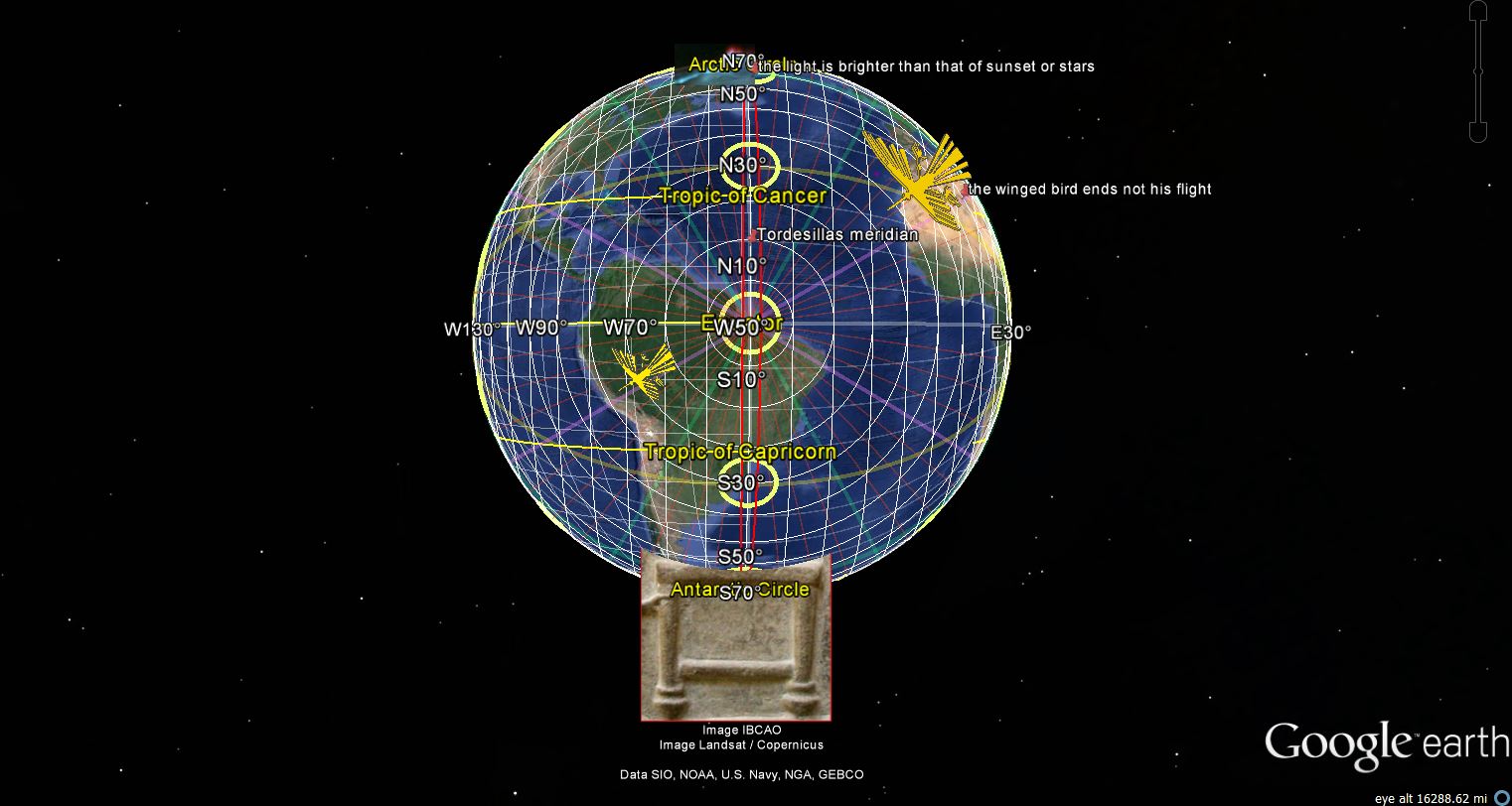
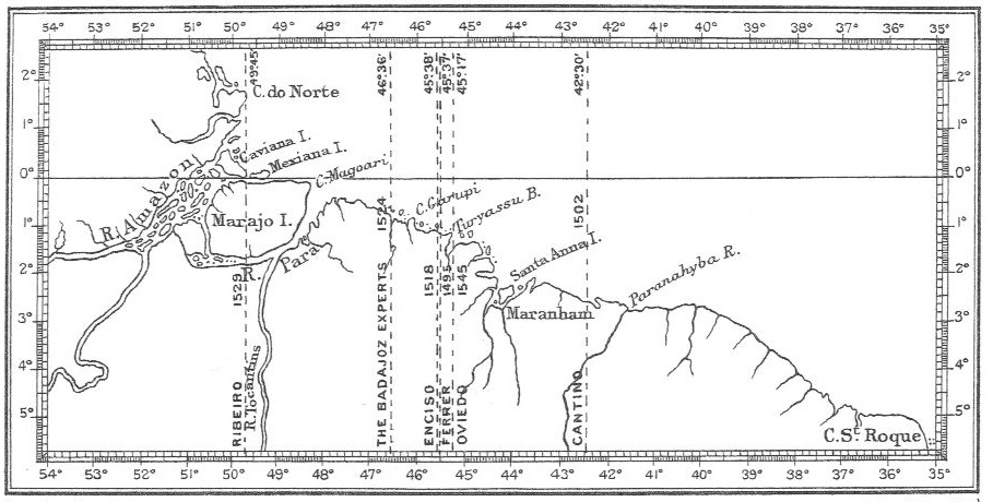
There is no better line defining the primordial meridian than the one passing nearby these places. We know the the ancients divided the circle in 4 and 8 parts. By doing thesame with the Earth, we define 4 primordial meridians: 1- Babylon, 2- Greenland-Marajo(Brazil)-Brasilia (Brazil), 3- Rapa Island(French Polynesia)-Line dividing Alaska and Canada, 4- Ayers Rock in Australia. The second coincides precisely with the Tordesillas meridian (-42 to -49 degrees longitude), which separated the world between Portugal and Spain: the 2 major maritime powers in 1492. This is not coincidence since it is believed that the conquistadores had prior knowledge of America and Ancient Maps.
Here is how we interpret this map:
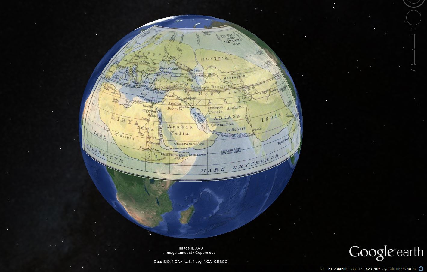
The next Map of extreme importance is the Eratosthenes map from 550 BC. It is very important because Eratosthenes measured the Earth's Circumference, he was third librarian in the Library of Alexandria and inventor of Geography. Of course, as librarian of be biggest librarian of the Ancient World, he had unlimited access to ancient maps and documents on ancient navigation.
We can clearly see that this map is also centred in Babylon, but have 3 major Meridians: Alexandria (Nile Delta), nearby Persepolis (Persian Gulf) and Mohenjo Daro (Indus Delta). This suggests a radial 30 degree line, originated in Marajo (Delta of Amazon) and passing by the 4 major Deltas: Amazon, Nile, Euphrates, Indus and Yellow River. We call this geographic coincidence Delta Line. The map of Eratosthenes may be suggesting that he knew about this alignment. The following map of Ptolomy (150 AD) center the world in the Persian Golf Meridian.
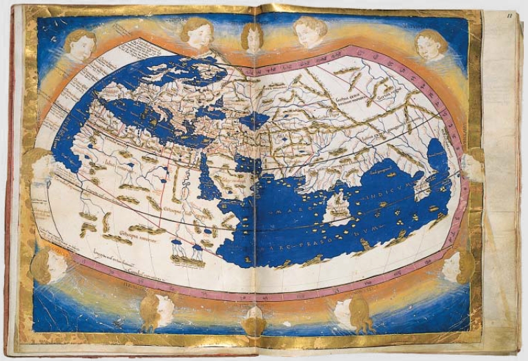
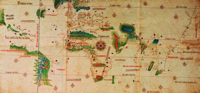
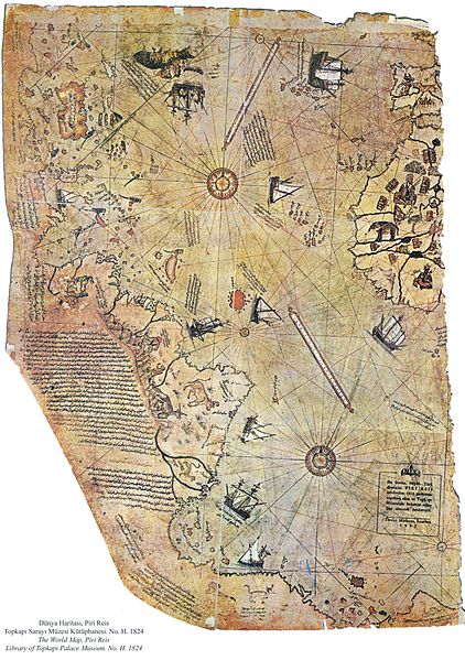
The two other maps of extreme interest are the map of Cantino and the map of Pirireis. Cantino's map shows Tordesilhas passing by NewfoundLand and Marajo. Pirireis map shows Antarctica, Tordesilhas and 2 major windroses: 23.5,-42.6 in the Atlantic North and -27.8,21.3 in the Atlantic South. (Early World Maps)
If Nazca is a World Map and is somehow linked to this tradition, it should depict its 8 pointed icon (Nazca Calendar) at the intersection of the Meridian of Tordesilhas (-42 to -49 degrees longitude) and the Tropic of Cancer (23.5). It also should contain an icon around Tropic of Capricorn (-23.5) and another one on the Equator. As a matter of fact, these 3 conditions are met with an astonishing precisision. The projection of Nazca Calendar is exactly 23.5,-48. The Arrow is exactly -23.5,-57 (Iguacu Falls). The Nazca Hummingbird follows the Amazon River and is exactly at 0.6,73 (Equator 30 degrees from Tordesilhas).
But that is not all, the Palpa Hummingbird follows the Delta Line at exactly 7,-36.5 degrees.
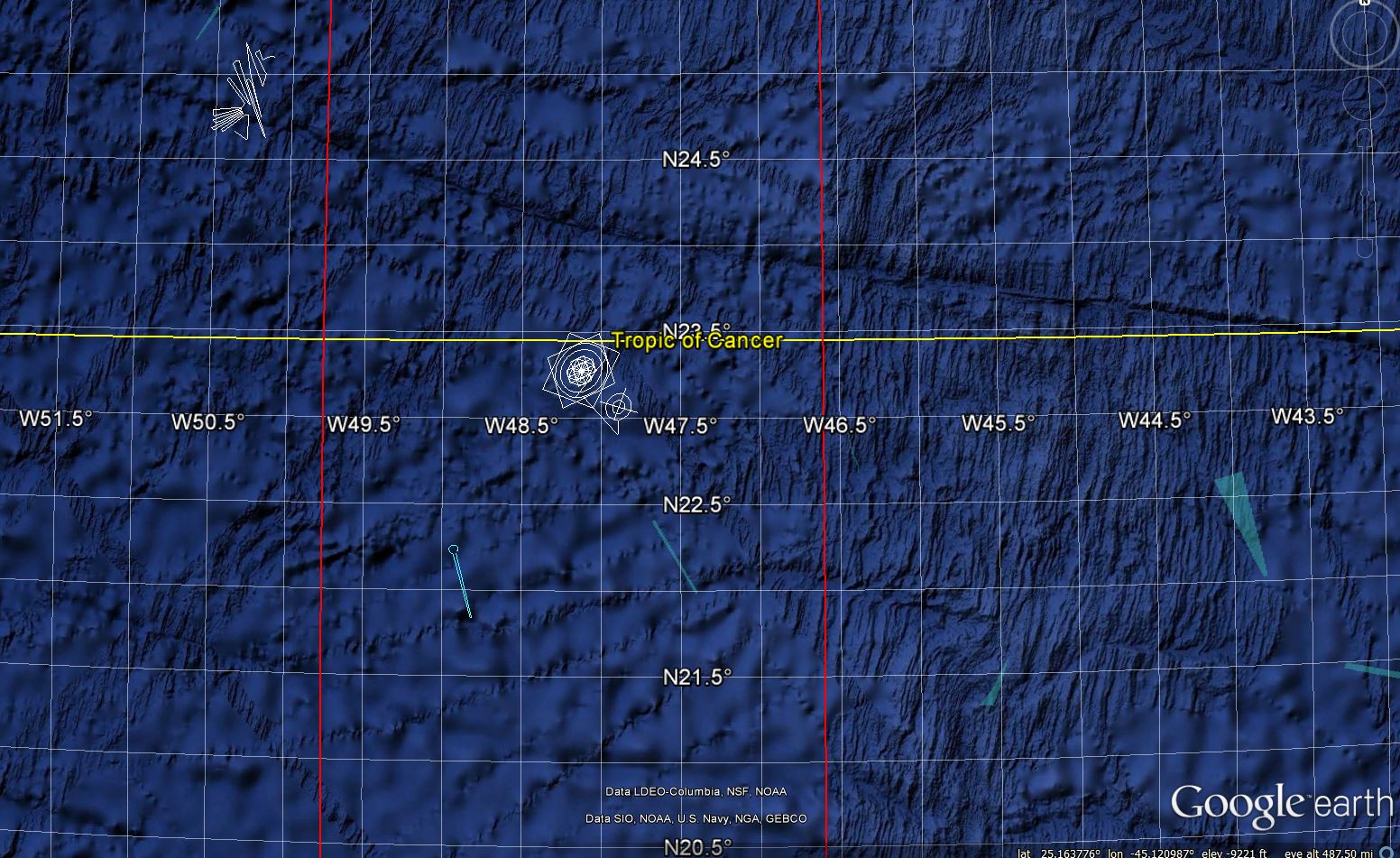
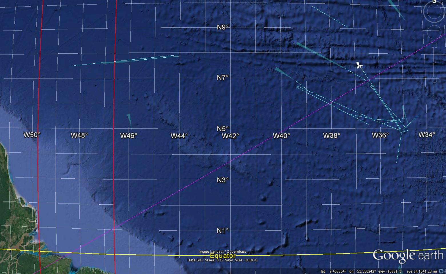
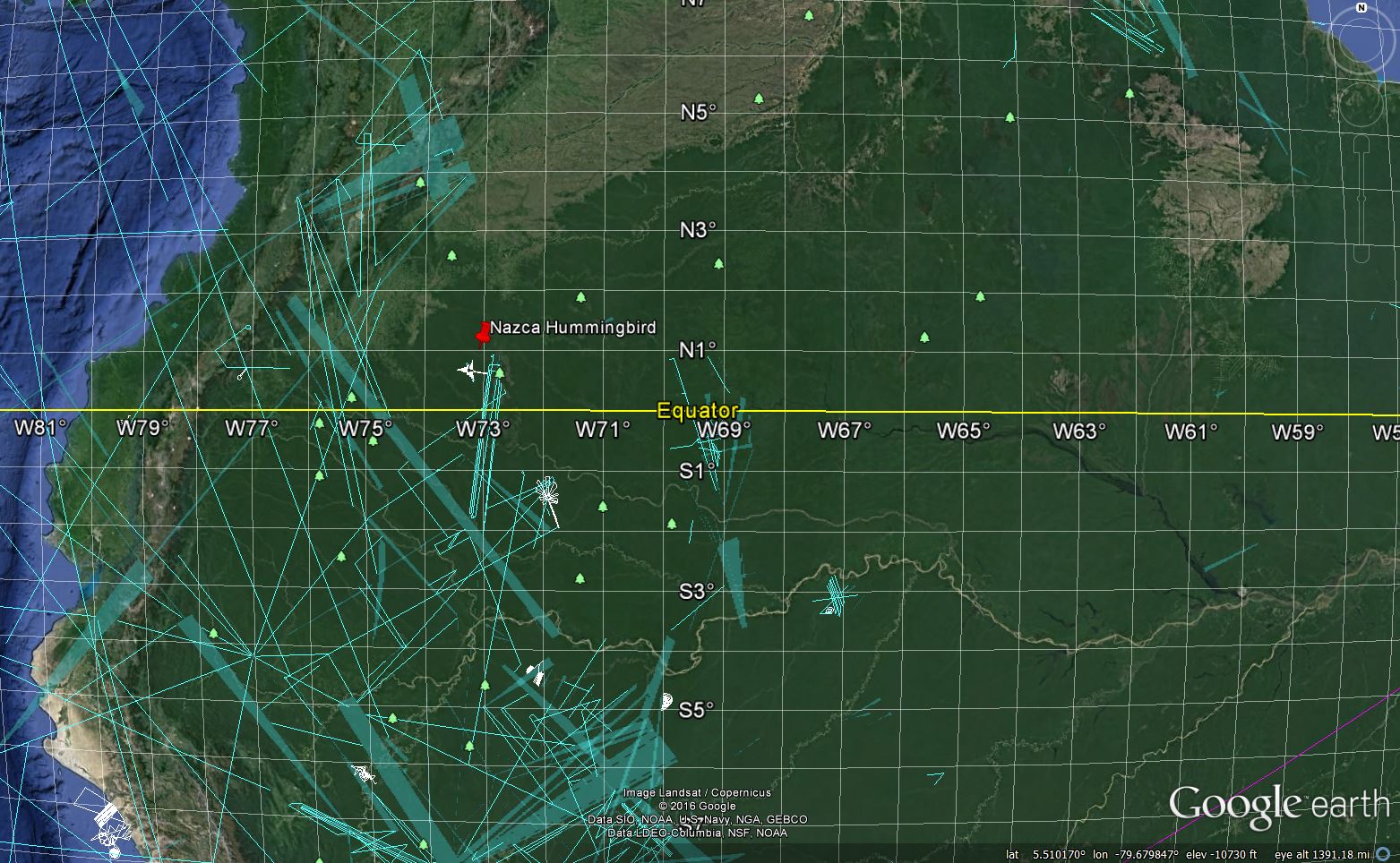
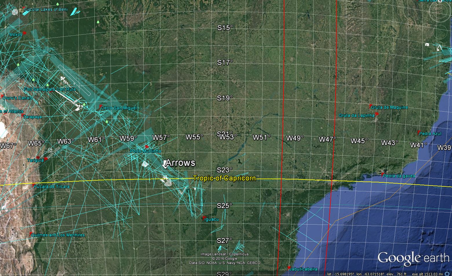
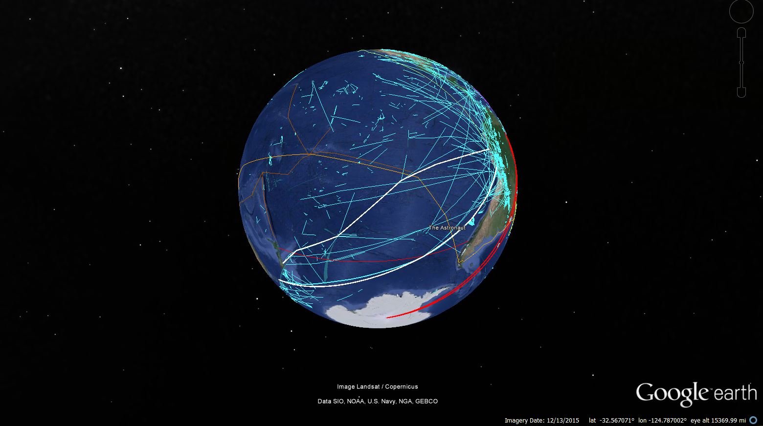
Other icons are multiple of 23.5 (Whale, Astronaut).
But what kind of map? It is a map reflecting the ceque system. We think it is a historical monument, reflecting the result of maritime and land explorations from the native people and/or outsiders. This tale is represented by the straight lines. Because of the topography, the map was rotated around 70 degrees to accommodate Earth's scale. If Eratosthenes was able to calculate Earth's Circumference, why not the advanced American pre-Colombian civilizations, which are at least contemporary of the Sumerians: Caral in Peru is carbon dated 2600 BC?.
The Nazca map has also other features:
- The Astronaut faces Easter Island, but at the same time indicates the South America Continent with an astonishing precision.
- The Whale is at the end of a route going from Peru to Australia, passing by Easter Island. The Small Bird represents New Zealand.
- The Condor represents the lands around Cuzco and Machu-Pichu.
- The Spider depicts the roof of the world around the Lake Titicaca.
- The Lizard represents the salty Lake Poopo.
- The Tree and the hands fit the salty lake Salar de Uyuni, which has a shape of a hand.
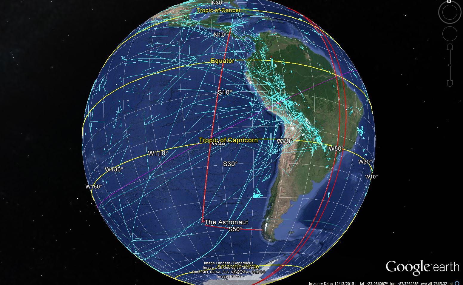
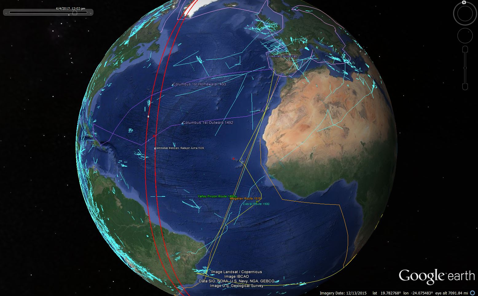
If we plot the routes followed by the great explorers, Colombo, Cabral, Magellan and others, we notice a very good match with the routes depicted in the Nazca Line.
- the Africa path includes the old Trans-Saharan trade route passing by Mali to reach Egypt (exactly Giza in the Nazca projection).
- Christopher Columbus trip to America passed exactly by the Nazca Calendar.
- Christopher Columbus return to Europe passed exactly by the Nazca Lines indicting this Route.
- Magellan, Pizon and Cabral routes to Brazil matches the Nazca lines Explorations projection.
- Magellan circumnavigation of the Globe from Brazil to Africa matches the Nazca Lines projection Route.
- The Pacific side shows the Land Explorations along the Coast and the successful ways found to Australia and New Zealand by Nazcans or Polynesians (White Bold Lines).
We leave to the readers their own exploration of this map using our app built on top of Cesium Maps (Cesium), where we explain icon by icon. Explore more with our App